
My most recent hiking trip (late Feb 2018) to Tasmania didn’t go to plan.
The plan was to walk the last section of the Western Arthur Range I hadn’t done – lakes Promontory and Rosanne.
But a flooded river and an indistinct track junction put paid to those plans.
While a little annoying not to tick off a few more Tassie bushwalking features, I still had five-and-a-half days of hiking and camping in the bush.
Day 1.
I set out from Hobart with my lift to the start of the Huon Track, near the Tahune Airwalk outside Geeveston, around 7.30am and was walking by 8.45am.
It was steadily spitting rain so I started in my waterproof jacket and pants. Handy too as the bush was wet and brushing past branches leaning into the track was like stepping into a shower.
The track is an old vehicle track and easy to follow, although in places the bush is reclaiming it.
I set myself a pretty quick pace as I was aiming to reach Cracroft Crossing, about 25km away, to camp.
The start of the walk was very nice. A couple of gentle up and downs and then flat walking along the Huon River.
It’s obvious no one has been along the track with a chainsaw for a while as there are plenty of trees down. They slowed my progress as they had to be climbed over or under or around.


I was relying on track notes in John Chapman’s South West Tasmania book. The edition I have, the fifth, is about 10 years old. To help me gauge my time I was aiming for a place called Blakes Shelter, which is described as a three sided shelter. It doesn’t exist anymore.
About 8km in the track begins to show why it’s nicknamed the Yo Yo Track – lots of steep climbing and descending of spurs, made harder by having to negotiate all the downed trees.
It wasn’t long before I was soaked with sweat under my waterproofs.
After about 10 hours of walking I made it to the campsite next to the Cracroft River, which I needed to cross to continue.
Throughout the day I’d been sloshing through flooded creeks and the Huon River had looked pretty full.
When I finally got to the Cracroft, it was obviously flooded. The water was running fast and looked deep. There was no way I was going to get across so set up my tent in a nice sheltered clearing, got dry, had dinner and finally settled into my sleeping bag around 9pm utterly exhausted.


Day 2.
I got up early and looked at the river. It still looked pretty flooded. I could see it had dropped a bit as the water was no longer lapping at the stick I’d placed in the ground to mark its level the night before.
I thought I’d test it and went into the water without my pack. I only got about 10 metres in. The water was up to my waist and getting deeper, the current was strong and it was a struggle to stay upright. There was no way I’d be able to get across with my heavy backpack.
The only thing to do was to give it a day and see if it would fall more. Thankfully the rain had stopped yesterday afternoon.


I also had a good book to keep me occupied – Big Little Lies by Liane Moriarty. I thoroughly recommend it. A page turner.
Throughout the day I checked the water level and could see it was falling.
Knowing that I’d lost a day of walking, I changed my plans to skip Lake Promontory and instead climb up to Lake Rosanne.
Day 3.
The river had continued to fall overnight and I was able to cross. The deepest the river got was to around thigh level and the current didn’t seem as strong.
The track notes say that the other side of the river has campsites and a toilet. Well, the toilet isn’t there anymore and the campsites aren’t that nice. They’re better on the eastern side of the river.
The weather was good although early morning fog blanketed the button grass plains.
I was aiming for a track junction that would take me up onto the Western Arthurs and Lake Rosanne.
Unfortunately, I missed it, which I realised when I reached Strike Creek, a lovely spot with a pebbly beach about two hours from the Cracroft.
I thought I could head back to try and find it but worried that if I didn’t spot it I’d just end up back at Cracroft Crossing.
So I decided to continue on the track I was on to Pass Creek, which is on the track to the Eastern Arthur Range and has a campsite, just for a change of scenery.
I’m glad I did as the views were spectacular, especially after the fog lifted as the sun came out. Rolling hills, button grass plains, and the Western and Eastern Arthur Ranges, including Federation Peak.


The campsite is nice. According to the track notes it has a toilet but it doesn’t. Which is its only downside as it’s surrounded by dense tee tree scrub which is hard to get through to find a spot to dig a hole.
Day 4.
The weather was fine again and I set out for a leisurely walk back to Cracroft Crossing.
I met a couple along the way and stopped for a chat, telling them of my unforeseen issues with the flooded river and missed track junction.
They said they thought they’d seen the junction and described a small pile of rocks as marking it.
I continued on slowly and found the pile of rocks and sure enough, a vague track heading off towards the Western Arthurs. Annoying. I think I missed it because a) it was pretty indistinct, b) I hadn’t read anywhere that that was what to look out for, and c) I wasn’t looking at the ground at this point of the track because the view ahead of me was spectacular.


Anyway, a lesson for next time and for anyone who might read this who wants to do the Western Arthurs from east to west, instead of the usual west to east.
The couple I’d met also warned that the weather was forecast to start raining again.
When I crossed the Cracroft again back to the campsite I’d become very familiar with, the water level had dropped again and was only around knee height at its deepest.
Day 5.
I wasn’t going to try walking out again in a day and planned to aim for a nice looking camping spot overlooking the Huon River I’d seen on the way in.
As the man said, it started raining again.
I carried a walking stick with me this time and I think it helped with climbing up and down the steep spurs again.
I reached the sheltered campsite after about six and a half hours of walking and didn’t feel too bad. The rain didn’t feel too bad either. It was more like steady spitting.


The campsite had lots of mozzies. It looked like something had been here before as there were some old star pickets lying around, an old saw and a cast iron jaffle maker. Bizarre.
That night I thought I was going to be hit by a big storm. There was a lot of thunder booming all over the sky but there was little rain with it. I learned later that Hobart copped the most of the storm.
Day 6.
My pick up was meeting me at 3pm back at the start of the track so I had a relatively leisurely walk out.
I think I finally found where Blakes Shelter used to be – looks like a big tree branch came down on it some time ago.
The weather was okay, not much in the way of rain. I was able to walk without the hood of my rain jacket on so could have a good look at my forest surroundings and the river.
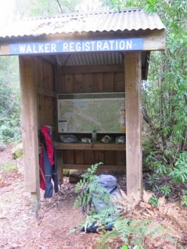
Had lunch and brewed a coffee at the walker registration shelter and read the graffiti – pro and anti logging stuff. Someone had also scrawled that there was no shelter at Blakes Shelter (I should have spotted that when I signed in at the start!).
Signed out
My ride was there to meet me and then it was back to Hobart to meet my family who’d come down to join me for the last days of my week off.
Overall, a nice trip, despite not getting to do what I intended. My new Asolo boots did a fantastic job sloshing through rivers, creeks and Tassie mud (no blisters) and my new Nemo sleeping bag was also very comfy.
Lessons
- My tarp continues to be one of the best bushwalking investments I’ve made. Fantastic to put up over my tent so if it rains at night I don’t have to pack up a wet tent. And I can back up under it in the rain.
- Think I’m old enough to start considering using a walking pole – the stick I used felt like it made walking easier.
- Dehydrating and making up meals at home makes dinner time so much simpler.
- I took less clothes this time and think it helped with weight and space in my pack.
